

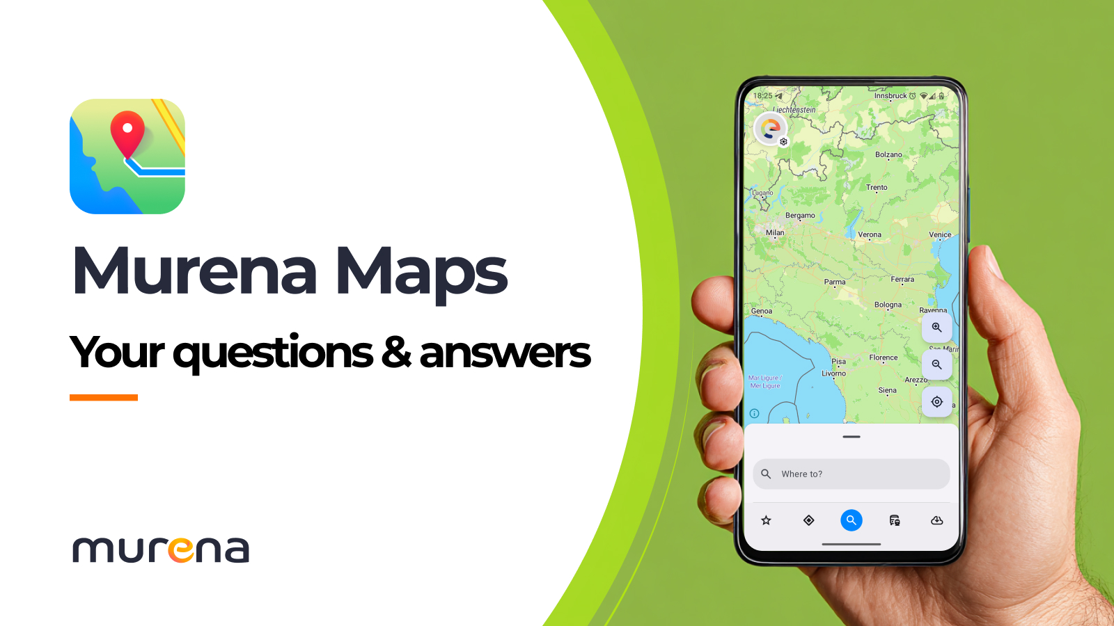
Murena Maps: Your questions and answers
About a month ago, we shared our first glimpse of Murena Maps, our new mapping app in development.
If you’re still feeling lost after reading the news – or just have a question or two about the project – this Q&A should put you back on track.
No need to wander through long intros: Let’s jump right to the questions!
1. Is Murena Maps open source?
Yes, you can find the source code on https://gitlab.e.foundation/e/os/maps.
2. What is Murena Maps based on?
Murena Maps is based on OpenStreetMap, MapLibre, WhosOnFirst, Transitous and several other open source projects and open data sources. It also relies on some hostable services. To know more about them, do not hesitate to watch 2min40 in this video: https://fosdem.org/2026/schedule/event/WRU7C9-cardinal-maps-application/
3. What’s the purpose of this mapping app? Aren’t there already other great open source mapping apps? 🧐
The reason for developing a mapping app ourselves is that none of the existing open source maps projects, although they are great, fit the needs that we have for this project.
Murena and /e/OS focus on building software for mainstream users. Therefore, we want to have a mapping app that instantly ‘just works’ when you open it. This is not the case with offline mapping apps that currently exist – they require route downloads. The goal is to build an online, native Android mapping app.
4. But for those who love downloading their routes – will this be possible with Murena Maps?
Yes, we are working on this.
5. Is Murena Maps free? Also in the car?🚗
Yes!
6. Will Murena Maps work with Android Auto?
We will do our best to make it work with Android Auto. This will not be included as a functionality for the first version, but we have added it to the topics to consider for the future roadmap of Murena Maps.
7. Will Murena Maps run on different Android-based operating systems?
Yes, it will certainly function on other AOSP (Android Open Source Project)-based operating systems as well.
8. Will Murena Maps sync with different devices and Murena Workspace?
This is priority number 1 for the team at the moment! 🤓
9. Will traffic data be integrated?
Yes, this is something we are working on.
10. Will there be a POI (point of interest) integration? 🚩
Murena Maps relies (among others) on WhosOnFirst, which is a collection of points of interest. We would love to give you the possibility to see ratings, comments and pictures, but are not sure yet, if this will be possible.
11. What other features are you considering for the future for Murena Maps?
We hope to make it possible:
- To make Murena Maps work without location enabled (to plan routes in advance)
- To integrate height, wide, length, weight settings in route calculation
- To include a streetview feature
- To announce street names
12. What if I don’t know how to use Murena Maps?
We will create a guide (either written or a video) to explain the different features.
13. But what if I don’t like Murena Maps? 😱
It is your choice to install any Android app you wish on your Murena smartphone. But we hope you’ll give Murena Maps a try before doing so!
13 Comments
Sounds interesting. As well as length, height and weight please add vehicle speed fir those of whose vehicle can’t alwsys resch the maximum speed limit. Regards, Andrew
Point 12:
Please do NOT make a video! I HATE being forced to keep watching a video until the point i am interested in is explained!
At least please consider providing a written guide as an alternative, too.
Will there be any data sent from the phone to any servers?
Will there be a browser and/or desktop client? I don’t want to have to get my phone out just to check out a route.
Hello, yes, an online version accessible from the browser is on our roadmap.
Hi, nice work so far.
Would it be possible to project a layer of walking- or bicycle tracks and route points on the map while navigating like it is in OsmAnd?
Hello Alli, this is not planned for now, but we are considering it for the future.
What about US addressing support? There currently aren’t any open source options that have this and it’s a must have for people in the states
Could you clarify what you specifically mean by “US addressing support”? Are you referring to features like address autocomplete, geocoding, ZIP code validation, or perhaps full data coverage for US locations?
Hey,
nice one! Are you going to implement a Maps category in the search of Murena Find? So if iam searching via murena find, i can directly click on a “maps tab”?
Hello Alexander, Thank you for the idea! We haven’t planned this yet, but maybe we will do it in the future.
in magic earth announcements were easy to understand.
In organic maps and osm announcements are difficult to understand.
Both are using espeak, which is quite a desaster.
Right now I am using osm without announcements to navigate to avoid the awful sound of the voice.
Can you please think about integrating a working speech generator?
Thank you for the idea! Indeed the voice should be easy to understand, especially in situations where you’re a bit lost. We will share it with the team.